Pancake Creek is a popular anchorage on the east coast of mainland Australia, 65 nautical miles north of Bundaberg and about 25 nautical miles south of Gladstone.
Approach and AnchoringEntry into Pancake Creek should be made on a rising tide as the tidal flow at the mouth of the creek can be very swift - up to 3 knots at times. We have watched a small sailboat sit in the mouth’s tidal race flowing out while trying to get in. He had his engine going full bore and a headsail out with the wind behind him, yet he still could not make way against the tide. He had to endure those conditions until the tide slackened, and then he came in.
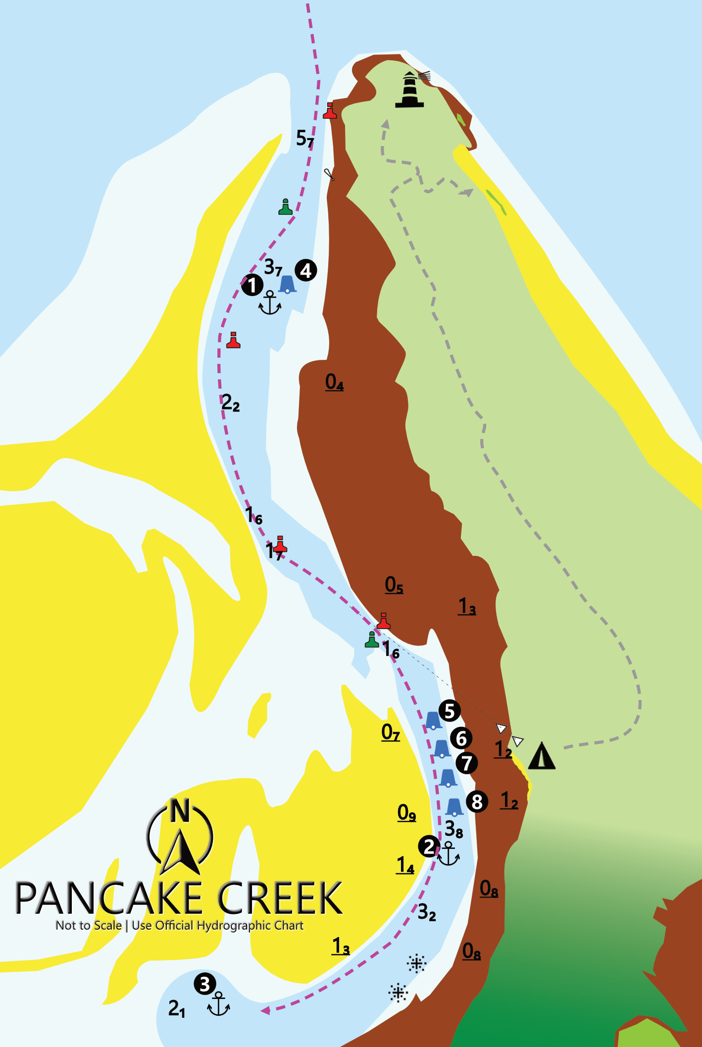
Arriving with an incoming tide also assists with navigating the shallow parts of the creek. Entry is straightforward, picking up the port markers off Clews Point and the floating starboard can marker. Just inside those two marks is a pool of good deep water (3-5m LWS) where one can anchor or pick up the single public mooring if wanting to make an early exit the next morning. This anchorage is protected from S-SE winds, but swell can invade the mouth anchorage depending on the tide. This outer anchorage is very swell-prone and open to northerly winds.
If you want a quieter night and intend to stay a day or more, ride the tide up the creek following your charts and buoyage. Pick up the port marker and round it to port, then make a beeline for the next port marker. As you round the second port marker, “the gate” marked by port and starboard piles lies ahead with white lead marks on the shore directly behind. Once clear of that, proceed into the anchorage area as shown on the map below. There are four public moorings available.
The mainland shore side of Pancake Creek is very rocky, and these rock ledges extend out a deceivingly long way. Anchoring in sand is best achieved by finding your preferred spot along the drying sandbank on the northern shoreline, allowing for swing room as the tides ebb and flood. Make sure you have a good hold as the tidal flow is swift. At low tide, the rocks, mudflats, and sandbanks show their true extent.
Once ashore, this is a delightful anchorage with good walks and beaches to fossick. Sandflies are a constant companion, and if having sundowners on the beach with friends off other boats, wear long garments and douse yourself in your preferred repellent. It might help, but it won’t save you.
Bustard Lighthouse Walk (Grade 2: Allow 30-40 minutes each way)
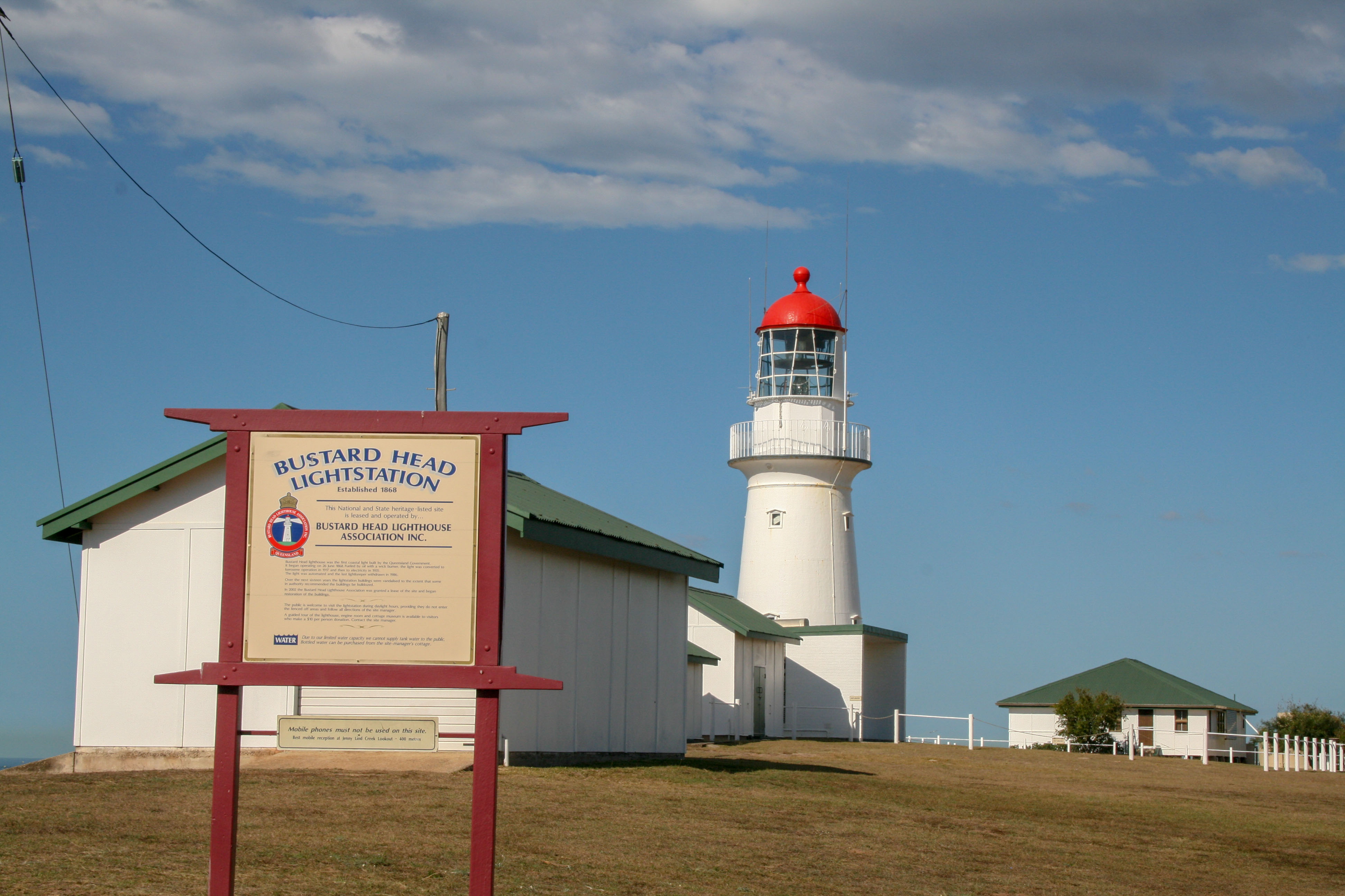
From the main beach at the national park sign, pick up the track through the bush which will come out to a patch of forest that has been invaded by saltwater and where the trees have died. Cross this moonscape in a straight line making for the bush ahead, and a bit of plastic chair has been placed in the tree to mark the track. Once back in the bush, helpful national park signs point you in the right direction all the way to “Aircraft Beach” and the Bustard Head Lighthouse.
For a small fee, you can get a guided tour of the lighthouse and outbuildings.

As you approach the lighthouse precinct be sure to visit the graves of early settlers of the region, some of who drowned in Pancake Creek. If you want to go further, there are walks to Jenny Lind Creek and a lookout a further 1.2km beyond the lighthouse.

Heading North?
NORTH QUEENSLAND'S ANCHORAGE ENCYCLOPAEDIA
Discover The Coconut Coast: Anchorages of the Townsville, Cairns, Cooktown and Peninsula (Cape York) Coasts from Gloucester Island in the northern Whitsundays all the way north to Princess Charlotte Bay. Experience counts. Cruise with local knowledge.
